By Justin Vanotti, Staff Engineer
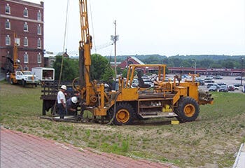
A geotechnical subsurface exploration program is crucial to any construction project because subsurface conditions are highly variable and can change drastically over short distances. Moreover, subsurface conditions can drive the design of a foundation system. For example, you would not want to construct typical shallow spread footings on compressible soils that will be susceptible to excessive settlement. Likewise, knowing the depth of fill or topsoil at a site is important; you do not want to be removing more than necessary as it can become costly. This information would be presented in boring logs, typically completed by a field engineer on-site. It is important to know and understand what the boring logs and subsurface results are telling you. This means recognizing where strata transitions may occur and what those strata or soil layers consist of. There are several ways to decipher subsurface logs and having a better understanding of them will help improve the design of the structure, roadway, or other construction projects where earthwork will occur. Below are some of the ways subsurface data can be analyzed and, hopefully, make it easier the next time someone sends a subsurface boring log your way. It’s a lot more than just dirt!
First, it is crucial to review historical geotechnical data of the site. This includes existing boring logs from the site or nearby sites, or possibly a surficial geology map of the area. Sometimes fill, granular soils, or possibly even glacial till can visually appear similar. Reviewing historical geotechnical data helps introduce you to what may have been previously encountered at the site and recorded in the boring logs. It can also be helpful to understand what past construction, if any, was performed. This can be useful when determining a depth of fill material and knowing where natural soils are located. Once you understand the types of subsurface soils that may have been encountered previously, you will be better able to understand what type of soil may be present at your site.
Next, the blow counts recorded in a boring log can also be good indicators of soil transitions. Geotechnical soil samples are collected by driving a hollow split-spoon (metal cylinder) into the soils with a 140-pound hammer. The number of hammer-strikes over 6-inches is counted and recorded. Generally, soil samples are collected over 18- to 24-inches, so a sample typically has three to four blow counts. For example, a sample driven about 24 inches could be as follows: 3, 4, 13, and 11. From these numbers, it appears the first twelves inches were softer, requiring only three and four blows, respectively, to move the split spoon 6 inches. Conversely, the next 12 inches were denser, indicated by the increase in blows needed to move the sampler 6 inches. This could mean there is a soil transition after the first 12-inches. Soil transitions are not always hard transitions as described in the example above but can occur gradually over depth. It is also important to pay attention to notes included in boring logs. Notes about wash color change, drilling action, or possible drilling fluid loss can provide clues regarding the subsurface conditions.
Soil color is also useful in evaluating soil transitions. For instance, natural sands may be lighter in color, while fill soils are often darker in nature due to presence
of organics and debris.
Having a photograph of each sample can be tremendously helpful. Most field staff will take a photo of soil and rock samples with a measuring tape and a jar lid with sample information to identify where the sample came from and at what depth. This is most utilized in the Quality Assurance and Quality Control phase of producing geotechnical data. Recently, the geotechnical engineers at Nobis have been providing sample photos for some projects with our geotechnical data as it allows clients to view a sample as it is collected in the field. The photos help clients see the color of the sample and in some cases the different grain sizes of the soil.
Besides soil strata, it is also important to have accurate information on depth to groundwater. As water can drastically affect how soil behaves, it can also drastically change the design of a foundation system. Construction is generally performed in dry soil conditions, so if groundwater is relatively shallow it can have a significant effect on the dewatering measures required at the site. Determining seasonal high groundwater is also a good indicator as to how high in a subsurface profile groundwater can reach. The oxygen in groundwater can react with and oxidize soil, resulting in orange staining of soil. This orange staining can be a good determination of the seasonal high groundwater level. The orange staining can sometimes appear as striping or intermittent spotting, called mottling or mottled soil, which is also a good indicator of a seasonal groundwater table.
One of the most direct ways to help decipher subsurface data is from laboratory testing analyses. Generally, particle size analysis or a sieve will be the easiest way to determine how much fine material (fines) versus coarse material is in a sample. If a sample has high fines, such as a clay or silt, there are other lab testing analyses that can be performed to help determine the physical properties of that sample. For example, a clay sample could be submitted for compressibility and/or strength testing. Knowing such information helps when designing a foundation system as its engineering properties can be more accurately modeled.
As is the nature of the business, subsurface conditions can vary significantly over short distances. Therefore, it is important to accurately interpret the results of a geotechnical exploration program. Utilizing the several ways highlighted above can help make it easier to assess subsurface material at a site.