Historical operations by Creese & Cook released tannery waste to environmental media consisting of animal hides and chemical contamination (asbestos, PAHs, arsenic, dioxins/furans, hexavalent chromium, and lead) posing unacceptable human health and ecological risks.
The Creese & Cook Tannery (Former) Superfund Site covers ~29 acres in and along the banks of the tidally-influenced Crane River in a heavily urbanized setting with active businesses and residential dwellings in Danvers, MA.
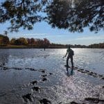
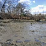
Between 2013 and 2020, Nobis completed RI/FS and risk assessment activities for OU1 and OU2 which are comprised of the east and west banks of the Crane River under contact to EPA Region 1 (SB RAC). The field investigations included surface geophysics to determine fill thickness, and bedrock depths; soil borings and sampling; riverbank sediment sampling; groundwater monitoring well installation and sampling; and tidal studies, slug tests, and water level monitoring. On-site field screening was performed for metals using XRF methods and for PAHs using immunoassay methods. In total, 1,500+ samples were collected for a variety of analyses.
Since 2020, Nobis has completed the PDI and RD for OU1 and OU2, continued community involvement support and is currently performing technical support (oversight) for EPA for the in-progress RA. Due to the site’s setting along both banks of the ecologically sensitive tidal Crane River, the design team worked closely with municipal and state regulators in addition to EPA to evaluate and streamline addressing applicable or relevant and appropriate requirements effectively in the RD. Nobis conducted a Phase 1b Archeological Survey, which was required due to the presence of several historic features including an early colonial cemetery that includes the remains of several prominent colonial-era families, residential structures, and the high potential of Native American artifacts along the riverbank. During the PDI, Nobis encountered areas of waste sludge materials and a subsurface containment cell for treated sludge materials. Nobis evaluated the geotechnical properties of this material to support the anticipated construction. The Nobis team worked collaboratively with EPA’s TRCA program to supply analytical data, site survey data, utility survey data, and other pertinent data to support two separate removal actions at OU1. Nobis evaluated the results of these removal actions as part of a CSM update and made recommendations for further evaluation. One of these evaluations required additional soil sample collection on an adjacent parcel to verify that site-related contamination had not migrated or otherwise come to be located on the adjacent property.
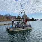
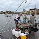
The RD included plans and specifications for excavation and consolidation of over 50,000 cubic yards of soil and sediment impacted by PAHs, dioxin/furans, and metals and placement into a soil consolidation area and construction of a Resource Conservation and Recovery Act subtitle D landfill. Design elements also include restoration of wetlands along Crane River which is tidally influenced. During the ongoing RA, Nobis has been providing daily oversight, construction management, and technical support to EPA. Concurrent with the RA oversight work, Nobis has been performing a RI/FS and risk assessments for OU3, which is comprised of three basins demarcated within the Crane River between and downstream of OU1 and OU2. The goal of the OU3 RI is to determine the nature and extent of site-related contamination in surface water and surficial sediment (top 0.5 feet of sediment), including a robust background study due to the urban environment and potential for multiple sources to be impacting the Crane River. he sampling program was designed to provide spatial coverage across the river channel, mudflats, and upstream/downstream transition areas. RI activities included the sampling of sediment, surface water, and biota including fish tissue and shellfish. The biota and shellfish sampling results are being used to evaluate bioaccumulation and food web effects to assess risks to both human receptors (fish consumption) and ecological receptors (wildlife) through the CERCLA risk assessment process.
challenges
- The primary access points to the site are from residential side streets and the site is bisected by the Crane River.
- RD was expedited and completed on-time for EPA to achieve its desired design completion date.
- EPA conducted several TCRAs at this site in 2024 necessitating evaluation of post-removal confirmation sample data and pre-remedial sample data from areas not subject to the removal actions to calculate an exposure point concentration (EPC) for comparison to established cleanup levels.
solutions
- Nobis identified two potential points of site entry from two arterial roadways which avoided accessing residential streets. Nobis determined that the southern entry point was not sufficient to support turning truck traffic. The northern access point is a former railroad grade crossing with an existing curb cut. Nobis identified that one utility pole would require relocation to provide sufficient turning radius. site access is provided along the railroad right-of-way (which is also part of the site) into the site. Nobis also evaluated rehabilitating an extant wood pile-supported railroad bridge over the Crane River to support truck traffic to both sides of the river. The structural evaluation proved that the cost to rehabilitate the bridge was significantly more than construction and maintaining a temporary steel frame truss bridge over the top of the existing railroad bridge.
- Nobis created a dedicated project working group that included a project manager, a senior engineer, a lead civil engineer, project civil and geotechnical engineers, wetlands scientists, and project geologists. This dedicated group was able to maximize the available time to achieve the desired design goal. Even with several significant EPA scope of work modifications, Nobis was able to achieve EPA’s desired design delivery date and finished the design project well within the established budget.
- Nobis recognized that performing a traditional 95% UCL of the mean would be biased heavily by a few locations where elevated concentrations remained. Removal of these results from the dataset as outliers was not a viable option. Therefore, Nobis performed a geostatistical analysis using Thiessen polygons derived from the removal confirmation sample results and the remaining pre-excavation sample locations. These polygons were then used to establish a volume-weighted EPC.
results
The successful completion of the RI, FS, and RD will allow EPA to move forward to the remedial action phase of the project and resulting in reduced human health and environmental risks.